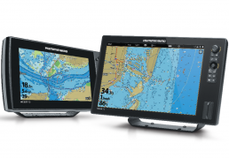
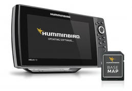
We’ve enhanced our out-of-the-box Basemap to deliver more detail for a superior angling experience. Available on many APEX, SOLIX and HELIX models, Humminbird Basemap is built off of data from Humminbird, NOAA, and other trusted cartography sources and provides a clear view of underwater structure and surrounding points of interest, so you can fish and navigate with confidence.
The Humminbird Basemap is available as a built-in feature on GPS-equipped APEX, SOLIX and HELIX G2/G2N and newer models. Combine this detailed Basemap with other powerful Humminbird technologies such as MEGA Imaging™, Dual Spectrum CHIRP Sonar, and AutoChart Live for an unmatched understanding of the water.
THE KEY TO
ANGLING SUCCESS
Making sense of it all just got a whole lot easier. Identify buoys, daymarkers, hazards, hotels, marinas and countless other navigation aids and points of interest with our comprehensive icon system. You’ll also see contours, depth markings and, for coastal areas, spot soundings. On the water, confidence is key. And the Humminbird Basemap delivers.
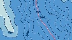
DEPTH CONTOURS
Know your depth and identify fish-holding areas.
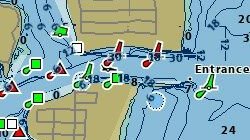
POINTS OF INTEREST
Spend more time fishing and less time searching with listings of docks, marinas, boat ramps and more for your body of water.
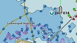
NAVIGATIONAL AIDS
Navigate more confidently with this comprehensive icon system identifying buoys, lights, obstructions, wrecks and more.
AVAILABLE VIA FREE DOWNLOAD